
Iles Park Neighborhood Association
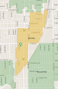
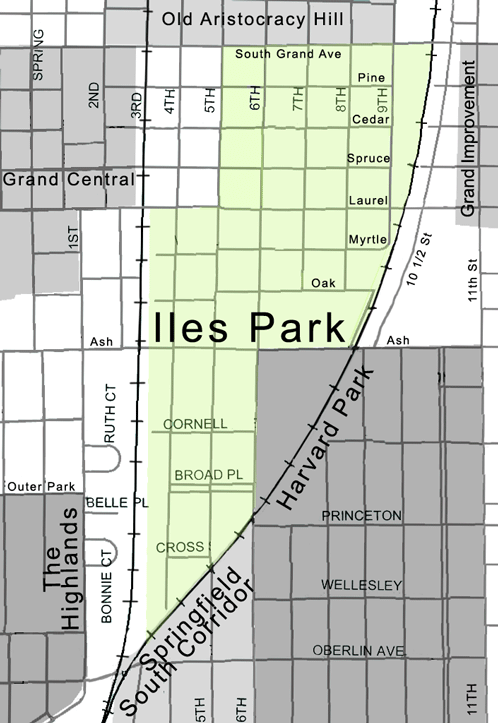
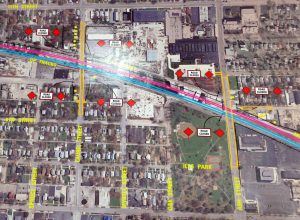
Iles Park is the neighborhood with the highest numbers of African Americans who will be displaced. The maps below show Iles Park Neighborhood boundaries. In the map on the right side you can see the current 3rd street tracks, and how that track will be moved east to 10th street for consolidation.
Originally formed in 1893, Iles Park boundaries now include:
- South Grand to Laurel between 5th Street and the 10th Street railroad tracks.
- Laurel to Ash between the 3rd Street railroad tracks and the 10th Street railroad tracks.
- Ash south to the tracks between the 3rd Street railroad tracks and 6th Street.
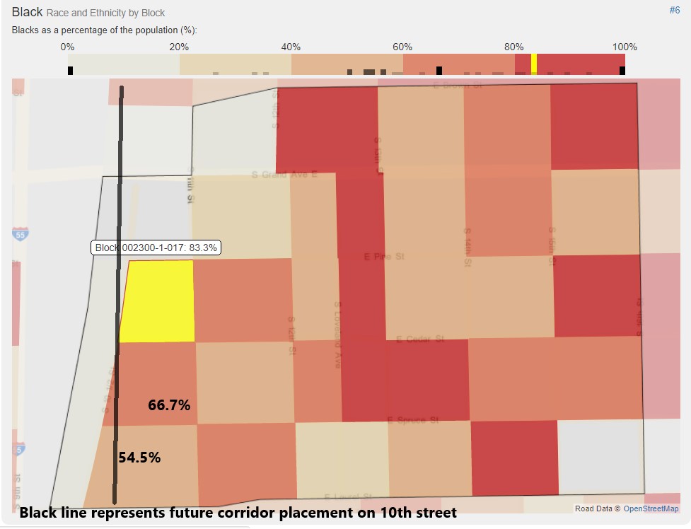
There had been controversy over moving the tracks east because it would place most of the burden on the African American community which is very prominent on the east side of town. Ironically enough, the African American population begins just east of the corridor, so it will serve somewhat as a racial boundary through Springfield. You can observe in the map below where the future corridor will be placed and its relationship to the African American population adjacent to it. The map is segmented by “blocks”; the highlighted block shows the highest (83.3%) African American population along the corridor, and the ones beneath it (66.7%, 54.5%) also reflect significant percentages.
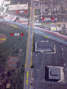
The Iles Park Neighborhood Association’s website discusses the implications of SRIP on their neighborhood and residents in their meeting minutes. They provided the following maps that illustrate displacement (by yellow dots) and the placement for the future underpasses. It is clear that the neighborhood will undergo significant transformation (2 underpasses in one neighborhood) however, the Iles Park neighborhood association was not listed as a stakeholder for the project. This is a compelling detail, because their voices will not be represented in the stakeholder feedback for the project.
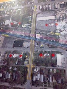 Laurel Underpass

Overview of both Laurel (on left) and Ash (on
right) underpasses
 Ash underpass showing both sides
Overview of both Laurel (on left) and Ash (on
right) underpasses
Citations
© OpenStreetMap data is available under the Open Database License, the cartography is licensed as CC BY-SA.
Iles Park Neighborhood Association. Retrieved November 3, 2017 (https://www.ilespark.org/)