
Area of Impact
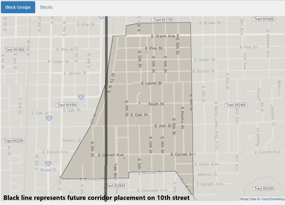
The map above depicts the placement of the consolidated track in Tract 001700 (encompasses underpass construction on Ash and Laurel. This image provides a close up of the impacted area.
Race Map – Concentration of African American Citizens
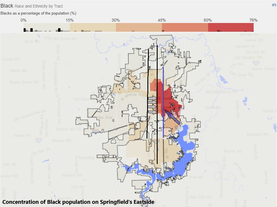
The map above shows the concentration of the African American population on Springfield’s east side. The highest African American concentration is depicted by the dark red highlighted area. The gray arrows illustrate how the 3rd street corridor will be consolidated to 10th street. The dark blue arrow depicts the 19th street corridor, which will stay intact, with the exception of added underpasses and updating. This map is a great reference point for those in the community who have concerns about the east side and the impact the project would make on that community. It also provides an illustration of the concern for the division/racial division of Springfield.
“In other words, the intention of physically and permanently dividing and devastating (my word) our city by accommodating a railroad industry without any benefit to the community is irresponsible… for the future of the community and railroad.” – SP43 (Community Voice)
“10th Street I think makes the most sense for the city without splitting the city in half in a crucial area. There would be less displacement of homes using 10th Street. It would also bring improvement to the east side area.” – SP143 (Community Voice)
Socioeconomic Status Map by Food Stamp Recipients
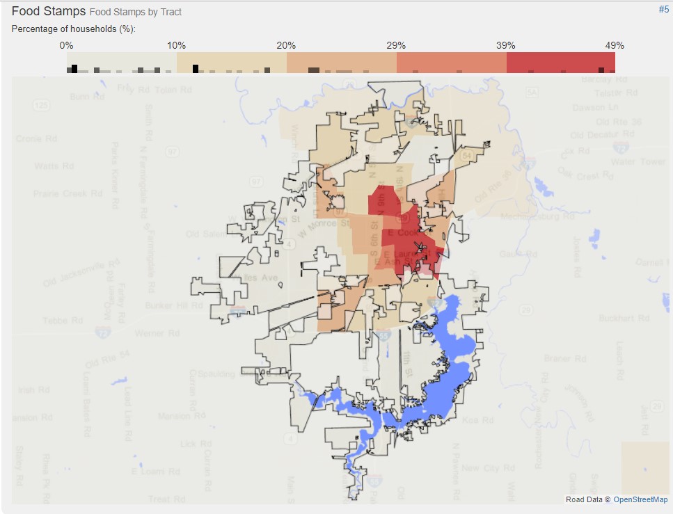
The above map shows the location of the concentration of people who receive food stamps (EBT) in the city of Springfield. You can see that this area overlaps with the area that has the highest African American population.
“I believe that the city will be safer. I believe that the city will be less divisive in terms of black, white, rich, poor. I believe that all kinds of economic development opportunities will flow from having this happen. I believe the city will be quieter. I believe the city will be enriched with all kinds of possibilities that emanate from a new multimodal center, a new set of tracks for Tenth Street, less kinds of activities and maybe no activity on Third Street, and one day maybe no 19th Street tracks.” SP60 (Community Voice)
Citations
© OpenStreetMap data is available under the Open Database License, the cartography is licensed as CC BY-SA.
US Department of Transportation Federal Railroad Administration. 2012. “Chicago to St. Louis Volume II – Appendix F–Public Hearing Documentation.” Comments 43, 60, 143. Washington, DC: Federal Railroad Administration. Retrieved October 29 , 2017 (https://www.fra.dot.gov/eLib/Details/L03995).